The Québec maritime Blog

-
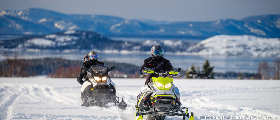
Notre-Dame-du-Portage, Bas-Saint-Laurent
Patric Nadeau/Tourisme Bas-Saint-Laurent
What to See by Snowmobile in Eastern Québec: Islands in the St. Lawrence
While visiting Eastern Québec, you’ll notice that many islands dot the waters of the St. Lawrence, particularly in the Bas-Saint-Laurent region. This popular snowmobile destination offers several trails with spectacular views of the frozen sea and snow-covered islands. Here’s a glimpse of what awaits you in this region.
How to get there and what to see
Once you arrive in the Kamouraska area via Trans-Québec trail #5 (TQ5) or Trans-Québec trail #35, you can follow regional trail #557 towards the coast. In the heart of the village of Kamouraska, you’ll have the opportunity to admire the Kamouraska Islands, which encompass Grande Île, Île aux Corneilles, Île Brûlée, Île de la Providence, Île aux Patins and Les Rochers. Take a moment to stop along the water to contemplate this landscape so typical of this area!
Between Saint-André-de-Kamouraska and Notre-Dame-du-Portage, local trail #45 has been named the Sentier des Pèlerins (literally “Pilgrims’ Trail”), after the nearby archipelago of the same name. As you ride along this trail for several kilometres, you can soak up magnificent views of maritime scenery. A cluster of five islands, Les Pèlerins is about 3 km (2 mi.) offshore and about 7.5 km (4.5 mi.) long. Opinions differ as to the origin of the archipelago’s name, but all agree on the beauty of this site!
Are you familiar with Île Verte? The only inhabited island in the region, it’s also one of the largest: it’s 12 km (7.5 mi.) long. Two local trails allow you to approach the shoreline to admire the snow-covered island up close: one from L’Isle-Verte (via TQ5) and the other from Cacouna (via TQ5 and regional trail #565).
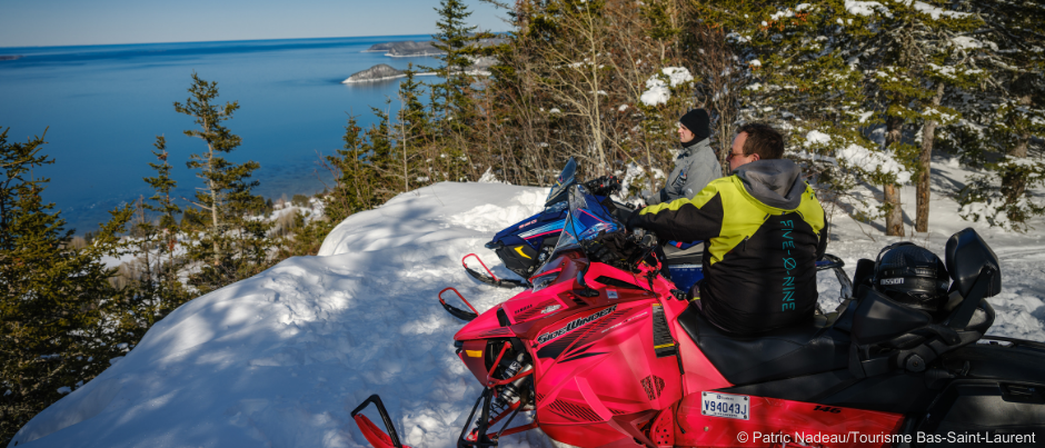
In the Saint-Fabien area, you can soak up a 180-degree view of the Bic Islands from a natural lookout. Dotting the frozen St. Lawrence, these islands are steeped in history and legend. From this promontory, you can admire Bic Island, the largest in the archipelago, and Bicquette Island, which is home to a lighthouse built in 1843. To get there, follow TQ5 to regional trail #518 and then take the local trail.
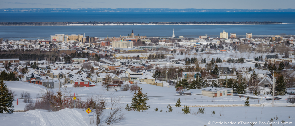
Off Rimouski, you’ll spot Saint-Barnabé Island, which is 5 km (3 mi.) long. Although the origin of its name cannot be established with any certainty, the name goes back several centuries: it appeared on Samuel de Champlain’s maps in 1612! Did you know that a hermit lived on this island in the 17th century? In fact, Toussaint Cartier spent almost 40 years there! You can admire the island on your snowmobile from several viewpoints: along local trails in downtown Rimouski or higher up on TQ5 when it overlooks the city.
Ride ideas
Several rides will give you access to some or all of these island vistas; which one you choose will depend in part on how much time you have for your trip. Here are some itinerary ideas:
For other ride ideas in Bas-Saint-Laurent, consult the snowmobile trail map for this region, which you can view or order on our website.
Which of these spots will you add to your itinerary for your next snowmobile trip in Bas-Saint-Laurent? You’re sure to be fascinated by this region’s mysterious islands!
If you liked this article, you might also like...
Author Anne-Josée Pineau

Born in Bas-Saint-Laurent, Anne-Josée Pineau loves this region and is delighted to introduce others to it. Never far from the sea, she’s fascinated by lighthouses and could live on seafood alone! On this blog, she likes to write about our regions’ unusual attractions, make your mouth water by describing local delicacies, and pique your interest by revealing some of the hidden beauty found in Québec by the Sea. In other words, she wants to provide you with lots of ideas for an unforgettable vacation!
(0) comment