The Québec maritime Blog

-
Monadnocks in Kamouraska
Mathieu Dupuis
Fascinating Landforms Created by Nature in Eastern Québec!
During a trip to the maritime regions of Québec, one cannot help but be amazed by the beauty of the landscapes. Mother Nature has certainly put her artistic talents to good use in these regions, creating mysterious islands, majestic mountains, a deep fjord, bright red cliffs and so many other wonders to admire. But do you know how these natural landforms were created? Keep reading to find out more!
Bas-Saint-Laurent
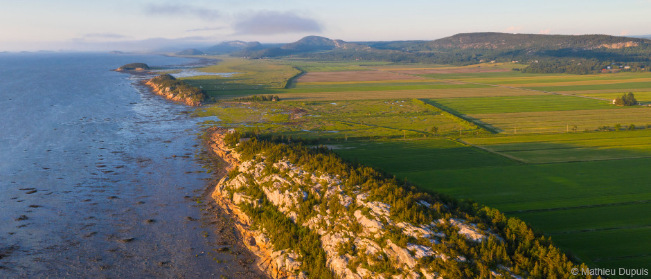
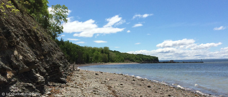
As you travel through Kamouraska, you’ll notice that the vast coastal plain in this area is dotted with intriguing rocky ridges. Known as monadnocks, a word derived from a First Nations term, and called cabourons by the locals, these mounds are composed of metamorphic rocks that resisted glacial erosion due to their superior hardness.

If you head inland, the coastal plain gives way to the Notre-Dame Mountains, which are part of the Appalachian chain. These mountains are 200 million years old and feature forest and agricultural land along with lakes and rivers. Their name was inspired by Jacques Cartier’s visit to the area in 1535!
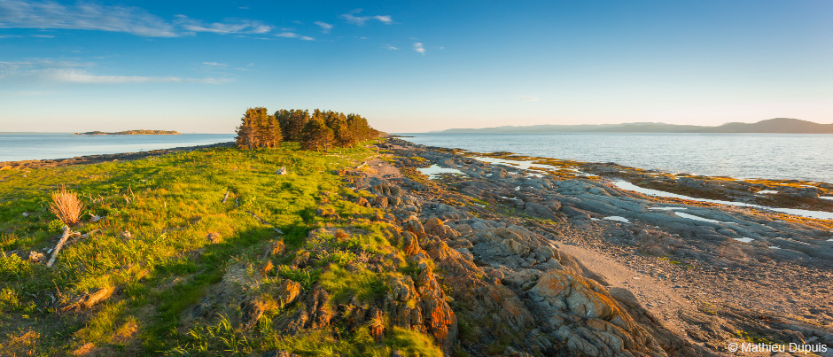
Finally, it’s impossible to talk about Bas-Saint-Laurent without mentioning the numerous islands that dot this segment of the St. Lawrence. Their size, shape and location are the result of geological upheavals caused by the retreat of the postglacial Champlain Sea some 6000 years ago, which created some single islands as well as archipelagos. The linear shape of many of these landforms is due to erosion combined with the direction of the water flow.
Gaspésie
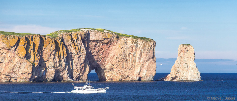
Located at the very tip of the Gaspé Peninsula, Percé Rock, the region’s most iconic natural landmark, is some 375 million years old. Shaped by the wind and sea, this limestone giant was once connected to the coast and had as many as four arches before taking on the appearance we know today.
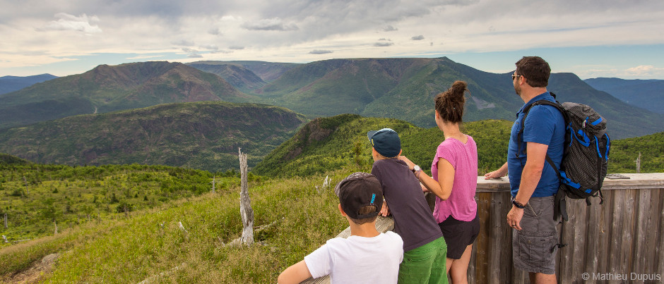
In the heart of the Gaspésie region, the Chic-Choc Mountains are among the highest in Québec, with 25 peaks over 1000 metres (3300 feet) high. Formed by underwater volcanic activity, this mountain range is said to be 600 million years old! Freeze-thaw cycles continue to shape it year after year.
Discovered in 1879 and added to the UNESCO World Heritage List in 2000, the Miguasha fossil cliff is made up of two distinct geological formations whose creation is directly linked to that of the Appalachians. While the older of the two contains rare coral and shell fossils, the other preserves the plant and animal fossils for which the site is famous. Miguasha offers the opportunity to discover 380 million years of history and evolution!
Côte-Nord
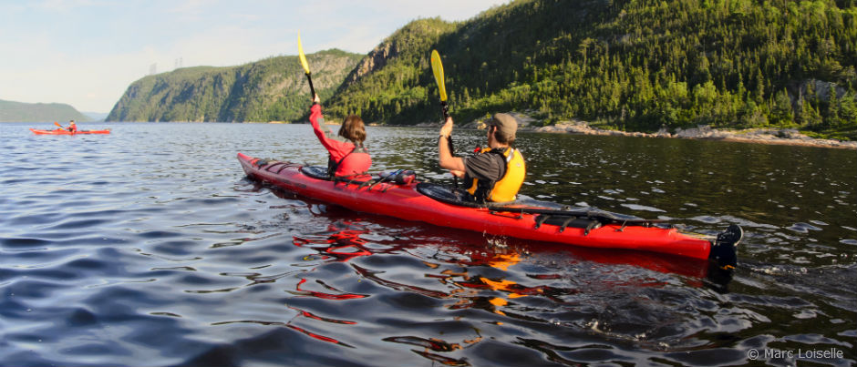
About 100 km (60 mi.) long and up to 3 km (2 mi.) wide, the majestic Saguenay Fjord, near Tadoussac, is one of the longest and southernmost fjords in the world. Created by collapsing rock over 175 million years ago, the fjord was gouged and polished by ice sheets and then flooded by seawater when the glaciers melted.
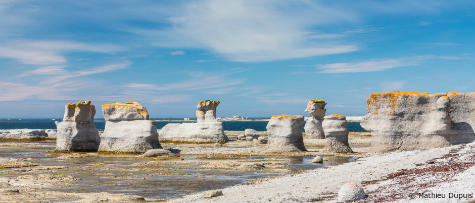
The landscapes of the Mingan Archipelago National Park Reserve capture the imagination, particularly because of the strangely shaped monoliths found there. Their story began some 20,000 years ago during the last major ice age. When the ice melted, the islands began to rise, and the monoliths were created as a result of a slow process of erosion that continues to this day.
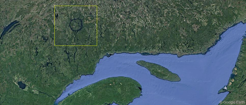
Visible from space, the Manicouagan impact crater, which is 72 km (45 mi.) wide, was formed following the impact of an asteroid somewhere between 213 and 215 million years ago. The construction of the Daniel-Johnson Dam, which flooded the crater and created René-Levasseur Island, gave the reservoir its distinctive appearance, earning it the nickname the “Eye of Quebec”!
Îles de la Madeleine
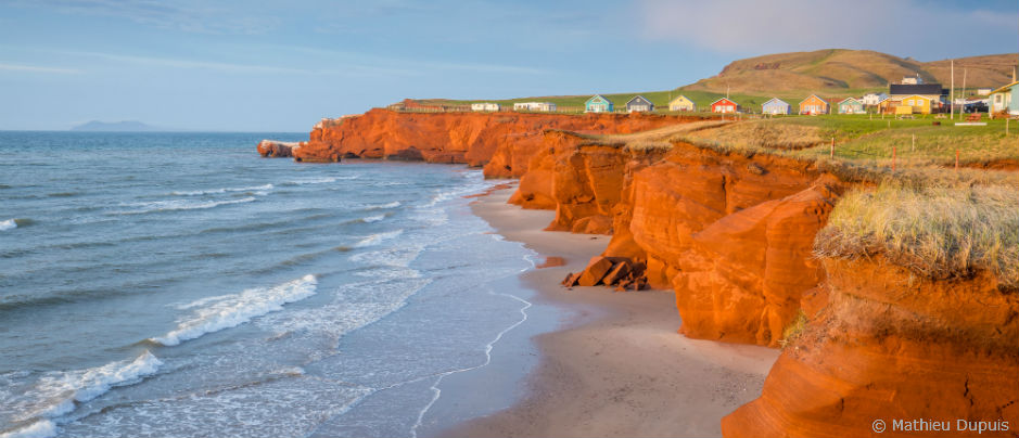
When visiting the Îles de la Madeleine, you’ll be struck by the red sandstone cliffs that line the coasts of the Islands. While their colour is due to the presence of iron oxide, their spectacular shapes are caused by the erosion of the extremely crumbly sandstone. In some places, this phenomenon has also caused the appearance of mysterious caves.
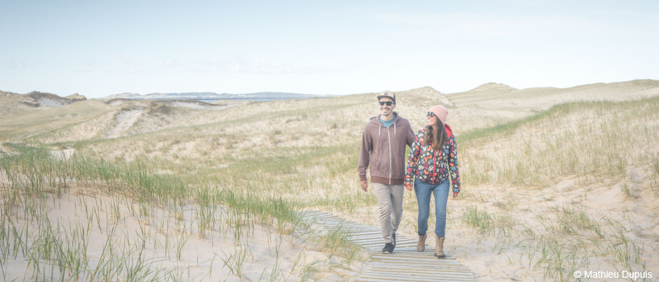
The Islands are home to many dunes, which are covered in maritime plants found nowhere else in Québec. Storms are constantly carrying new plant materials onto the beaches; once established, these plants help block the wind, which leads to the creation of small mounds of sand. Over time, other plants establish themselves along these mounds, stabilizing the dunes with their roots. When parallel dunes connect, they trap water between them and create lagoons.
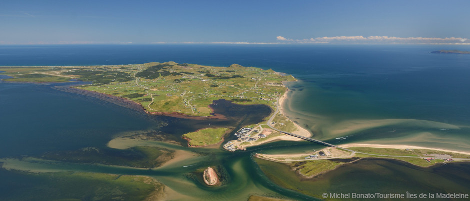
Did you know that the archipelago lies on a layer of salt? Some 320 million years ago, before continental drift separated many of the world’s major land surfaces, high temperatures caused a thick layer of salt to form in the basin in which the Îles de la Madeleine were located. Once the archipelago migrated north to its current location, this salt was covered by rock and lava. Several million years later, the pressure of this rocky layer caused the salt to rise towards the surface, creating the salt domes on which the Islands rest today.
Does this blog post inspire you to want to see all these natural landforms for yourself?
Sources:
- Kamouraska Wikipedia page
- “Landscapes” on the Tourisme Îles de la Madeleine website
- “Le Saint-Laurent insulaire” (in French only) by Lorraine Guay in Continuité (85), 2000, pp. 19-23
- Manicouagan Reservoir Wikipedia page
- Notre-Dame Mountains Wikipedia page
- Percé Rock Wikipedia page
- Sépaq
- “When Stone Recounts the Past” page on the Parks Canada website
Author Anne-Josée Pineau

Born in Bas-Saint-Laurent, Anne-Josée Pineau loves this region and is delighted to introduce others to it. Never far from the sea, she’s fascinated by lighthouses and could live on seafood alone! On this blog, she likes to write about our regions’ unusual attractions, make your mouth water by describing local delicacies, and pique your interest by revealing some of the hidden beauty found in Québec by the Sea. In other words, she wants to provide you with lots of ideas for an unforgettable vacation!
(1) comment
Pieter D Brown (Ottawa ON)
Anne-Josee: you are so right - the whole Bas St-Laurent is incredibly beautiful to explore : I have sailed along both the North & South Shores, cruised up the Saguenay -as well as by car many times, (once had relatives at Metis-sur-Mer).And on the rocks at Phare Metis, (Iles des Goelands - (sp?) - we found strange inscriptions which didn't look like natural markings...(some believe they could be Viking "runes" - ???). Anyway, your blog is excellent! :) Capt PD Brown