The Québec maritime Blog

-
Parc national de la Gaspésie
Mathieu Dupuis
Parc national de la Gaspésie: A Hiker’s Favourite Trails
Parc national de la Gaspésie offers so many hiking options that choosing a trail can be hard! Here are some suggestions among my favourites in the park, whether you have a few hours to hike or a full day.
Mont-Olivine
Length: 8.8 km / 5.5 mi. (return trip) | 11.4 km / 7 mi. (loop)
Elevation gain: 365 m (1200 ft)
Trailhead: Ruisseau-Isabelle parking lot
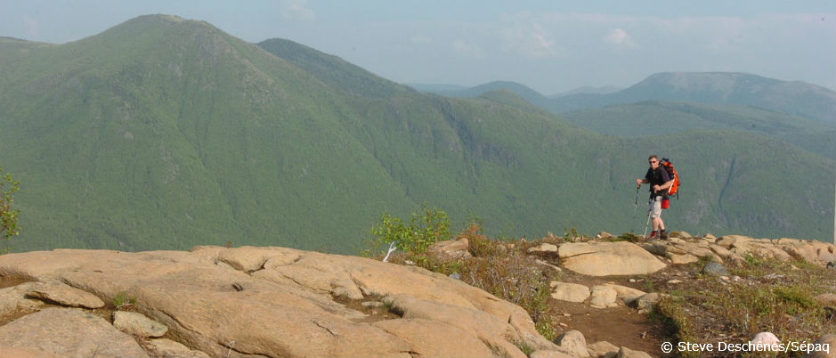
This trail probably offers the best payback in beautiful views for the level of effort required! The climb up Mt. Olivine is fairly gradual all the way to the ridge. Completely bare, the peak offers a stunning 360-degree panoramic view that includes the bowl on Mt. Albert and Lac du Diable. Once you’ve reached the top, you can choose to retrace your steps or complete the rest of the loop, which will take you by the Serpentine shelter where you can pause for a well-deserved break out of the elements.
Pic-de-l’Aube
Length: 12 km (7.5 mi.)
Elevation gain: 370 m (1215 ft)
Trailhead: Pic-de-l’Aube parking lot on Route 11
This trail leads to the most spectacular viewpoint from the summit of the impressive Chic-Choc mountain range. Wide and on a constant incline, it follows an old logging road to the top of Pic de l’Aube. On a clear day, the view of the St. Lawrence is simply divine. On the way to or from the trailhead, be sure to stop at Lake Paul where you’re likely to see moose.
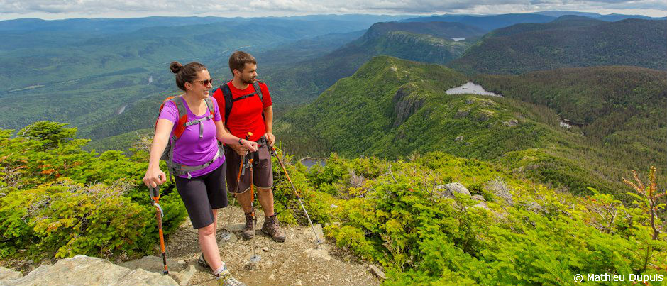
Mont-Richardson
Length: 11.6 km / 7.2 mi. (return trip) + 4 km (2.5 mi.) for detour
Elevation gain: 705 m / 2310 ft
Trailhead: parking lot on Route 160
This trail is a fall classic, but the many views it offers make it an appealing option in any season. After the first section of the trail, which is the most strenuous, a short detour will take you to the Surplomb, a lookout that offers a view of the Lac aux Américains glacial cirque. (You could choose to make this your destination if you’d prefer a shorter hike.) In the second section, which leads to the top of Mt. Richardson, you may be lucky enough to encounter caribou. This summit is also one of the few spots in the park from which you can see both Mt. Jacques-Cartier and Mt. Albert.
Have these suggestions piqued your interest? Visit the Parc national de la Gaspésie website to find out more about these and other hiking trails and help you plan your stay in the park!
If you liked this article, you might also like...
Author Jean-Pascal Côté

A certified translator and avid outdoorsman, Jean-Pascal Côté works as a freelance writer and translator in Bas-Saint-Laurent, the region where he was born. He regularly escapes his daily life by going road biking, cycle touring or cyclocross racing, skiing in the mountains of Bas-Saint-Laurent or Western Canada, or sea kayaking on the St. Lawrence River. He is constantly dreaming up new travel plans. He also blogs (on an admittedly irregular basis) about his cycle touring adventures.
(1) comment
Arun
How difficult are the trails for a new hiker or someone who doesn't walk a lot? Is it too steep?
Hello Arun. It depends wich trail you take. You'll find more information on this website (www.sepaq.com/pq/gas/index.dot) in the hiking section (Table of trails). The trails are easy, intermediate or difficult and you have more details like length, duration and altitude. I hope this will be helpful! | Marie-Eve - Équipe Québec maritime