The Québec maritime Blog
-
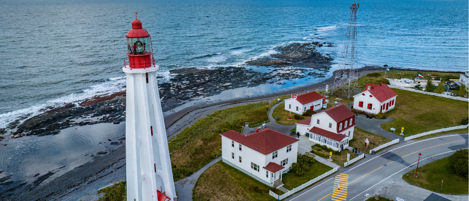
Pointe-au-Père Lighthouse National Historic Site, Bas-Saint-Laurent
Sébastien St-Jean
Surprising Facts about Parks Canada’s National Historic Sites
Discover a Rich Maritime History
The maritime regions of Québec have a rich and varied history. From the top of a lighthouse to the bottom of the sea, there are many surprising facts about our maritime history for you to discover… provided you’re not scared of heights or depths! Here are a few about the Pointe-au-Père Lighthouse and the Battle of the Restigouche national historic sites.
Pointe-au-Père Lighthouse National Historic Site
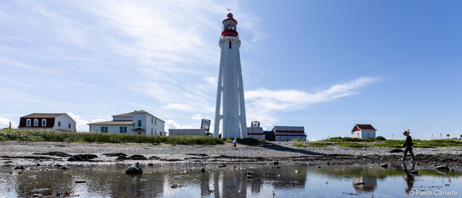
A lighthouse with a twin!
The Pointe-au-Père Lighthouse stands on a rocky outcrop on the south shore of the St. Lawrence Estuary. A white tower topped with a traditional cast-iron lantern painted red, this sentinel of the sea has caught the eyes of visitors and been a local source of pride in Bas-Saint-Laurent since it was built in 1909.
One of the things that makes this 33-metre (108-foot) lighthouse so distinctive is its striking architecture. You might think it’s the only one of a kind given that its reinforced concrete tower is octagonal and supported by eight flying buttresses. However, it actually has a twin on the other side of the country!
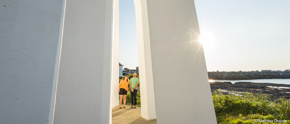 Flying buttresses support the tower, protect the lantern from strong winds and wow visitors!
Located on the west coast of Vancouver Island in British Columbia, the Estevan Point Lighthouse was also built in 1909. As at Pointe-au-Père, the buttressed base appears to anchor the octagonal tower to the shoreline. And similarly, this familiar landmark, which is about 30 metres (100 feet) tall, is the centrepiece of the lighthouse station.
Like its shorter west coast twin, the Pointe-au-Père Lighthouse bears witness to the architectural and technological advances that began in the early 20th century.
Cutting-edge technology
Since the Pointe-au-Père navigational aid station was established in 1859, the site has been at the forefront of impressive technological advances in the field of maritime communications.
Since 1909, the lantern has housed a dioptric lens, a marvel of technology. This massive component focuses and projects light so effectively that the beam is visible from the middle of the St. Lawrence, about 30 km (20 mi.) from the shore.
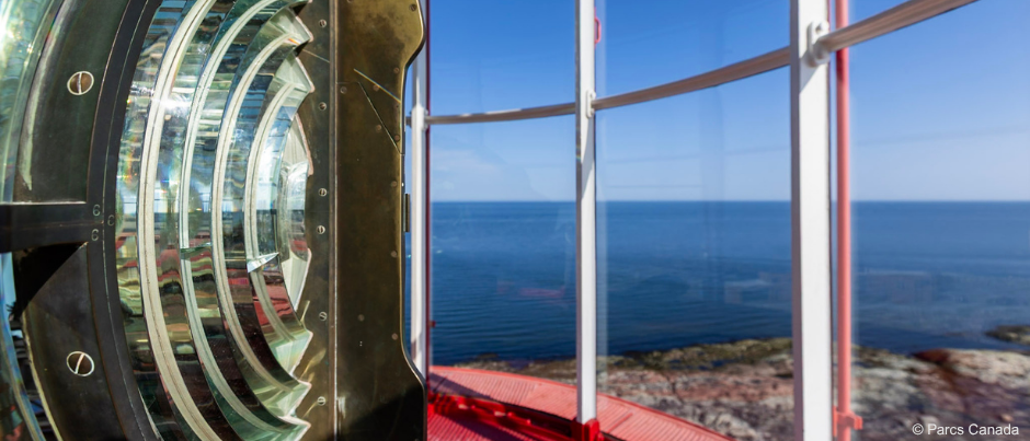 Originally resting in a mercury bath to ensure smooth rotation, the lens mechanism weighs over a tonne (2200 pounds). The site was of course decontaminated before being opened to the public.
Whenever weather conditions reduced visibility at sea, the lighthouse beacon was replaced by a sound signal to ensure sailors could navigate through the fog. At the turn of the 20th century, sirens replaced explosive devices, such as a cannon and bomb signals. The diaphone, a giant compressed-air whistle, produced a louder warning that carried over longer distances. The importance of this technology was such that it even required the presence of an engineer on site.
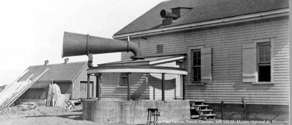 The effectiveness of the diaphone’s signal depended on wind direction. A tailwind acts as a carrier wave, allowing sound to travel farther and faster.
Thanks to the Marconi station, which began operations in 1859, distress signals from ships were quickly interpreted onshore. In fact, it was the telegraph operator at Pointe-au-Père who, in 1914, received the distress signal from the Empress of Ireland, whose sinking is one of the country’s worst maritime tragedies.
The Pointe-au-Père Light Station was a pinnacle of innovation and served as a testing ground for new communications technology. A visit to the “River Sentinels” exhibition at the national historic site will offer you a glimpse into a little-known yet historically significant chapter of our maritime heritage. Explore this exhibition in the lightkeeper’s house.
Battle of the Restigouche National Historic Site
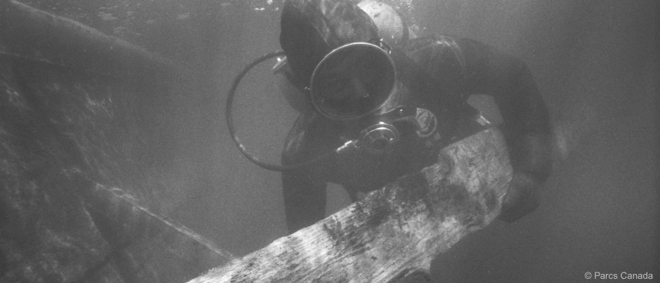 Diver Bob Masse bringing up a piece of wood from the Machault.
Discovering the remains of the Machault
Starting in 1969, a Parks Canada underwater archaeology team began excavation work in the Restigouche Estuary. A vast collection of objects was unearthed, including barrels of salted meat, tableware, shoes, masts, cannonballs, oak planks, etc. A new chapter in the history of New France was slowly resurfacing after lying dormant at the bottom of the estuary for over 200 years.
Welcome to 1760 at the Battle of the Restigouche National Historic Site!
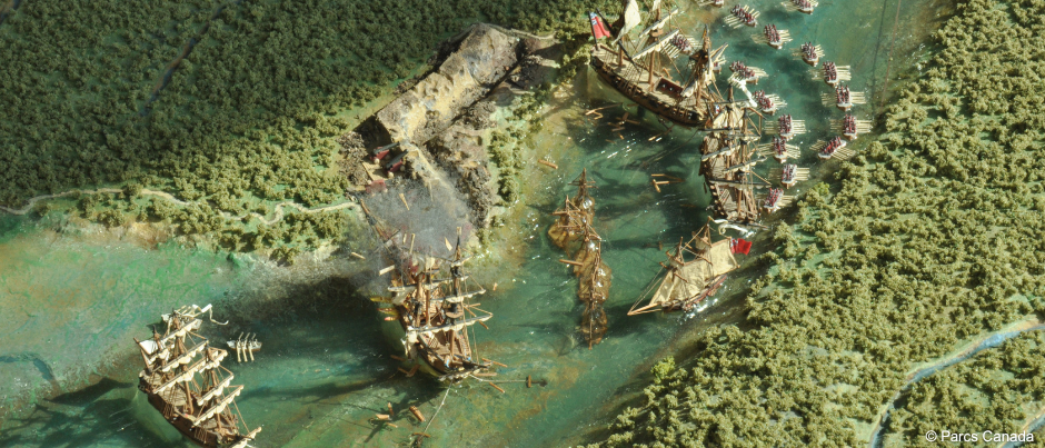 Detail of a model depicting the Battle of the Restigouche, on display at the historic site
Attempting to rescue the French colony
Let us recall a few historical facts from this crucial period. Two European powers, France and Great Britain, were vying for control of New France. The British navy gave Great Britain a clear advantage over their rivals during this phase of the Seven Years’ War. However, France had not lost hope. In 1760, a small relief fleet set sail from the port of Bordeaux to bring supplies, ammunition and soldiers to New France. Leading the expedition was Le Machault, a 26-gun frigate manned by about 150 crew members and 100 soldiers.
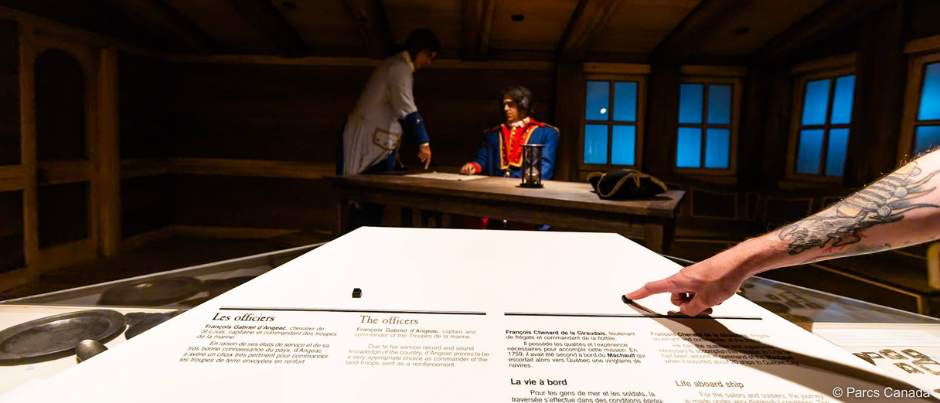 Aboard Le Machault, Frenchman François Chenard de La Giraudais (represented on the right in this reenactment) commanded the small fleet tasked with supplying and defending New France.
Taking refuge in Chaleur Bay
The commander of the French expedition, François Chenard de La Giraudais, was tasked with supporting the troops in Québec. Outnumbered and outgunned by the British navy, the French were forced to retreat. Had La Giraudais followed the orders of King Louis XV, he would have led his fleet to safety in New Orleans. Instead, he chose to enter the mouth of Chaleur Bay to take refuge and find drinking water for his men. Unfortunately, the English commander learned of his position…
A battle lasting several days ensued, culminating on July 8, 1760, when two French frigates were scuttled, including Le Machault.
Over 200 years later…
Le Machault thus sank to the bottom of the Restigouche Estuary, its cargo slowly disappearing beneath layers of sediment over the course of more than 200 years.
Ironically, the fate of this imposing vessel was a blessing in disguise for the underwater archaeologists who began working in the Restigouche River in 1969. Buried under one or two metres of fine, compact sediment, the artefacts recovered during the excavations had been protected from oxidation and light. Even objects made from organic materials (including wool stockings, combs made of horn and wooden planks), usually more prone to deterioration, were recovered in very good condition. This leather shoe is one such example.
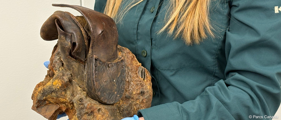 A Parks Canada employee holds a shoe encased in a concretion recovered during underwater archaeological excavations in the Restigouche Estuary.
Does the shoe fit?
Shoes like these were packed into barrels destined to supply the colony of New France in the 18th century. Surprisingly, they were all made in a similar cut, with no distinction between the right and left foot… so you can imagine how comfortable they were! The situation demanded it: French shoemakers had to quickly produce large quantities of shoes to supply New France, which was on a war footing.
The artefacts on display in the permanent exhibition at the Battle of the Restigouche National Historic Site have greatly contributed to our understanding of the history of New France. They also shed light on the relationship between France and its colony during a period of great tension in North America.
Come and discover a fascinating chapter in the maritime conflict between France and Great Britain at the Battle of the Restigouche National Historic Site, which is located in Pointe-à-la-Croix, in Gaspésie.
From the top of the Pointe-au-Père Lighthouse to the mouth of the Restigouche River, Parks Canada’s national historic sites are brimming with unique history that is sure to amaze you!
If you liked this article, you might also like...
Author Parc national Forillon

Located at the northeastern tip of the Gaspé Peninsula and mainly covered in forests, Forillon National Park protects an area of 245 km² (95 sq.mi.) and is home to rich and abundant wildlife, coves where curious seals swim, and striated cliffs where thousands of seabirds nest. In addition, the plant biodiversity of this natural territory includes several protected species.
Forillon also commemorates the peninsula’s rich human history. While the Mi’gmaq have occupied this territory since time immemorial, a few houses on a hillside come alive in the summer to tell the stories of the fishermen-farmers of various origins who lived off cod fishing in Forillon until the park was created in 1970.
Discover the seasonal charms of Forillon’s coastal landscapes, explore trails for hikers of all levels and stay in the park at a campsite or in a unique glamping unit. A visit to Forillon National Park is an opportunity to enjoy authentic moments in harmony with nature along the coast by the sea and on forested mountains.
The Parks Canada Gaspésie Field Unit manages Forillon National Park as well as the Pointe-au-Père Lighthouse National Historic Site and the Battle of the Restigouche National Historic Site.
(0) comment