The Québec maritime Blog

-
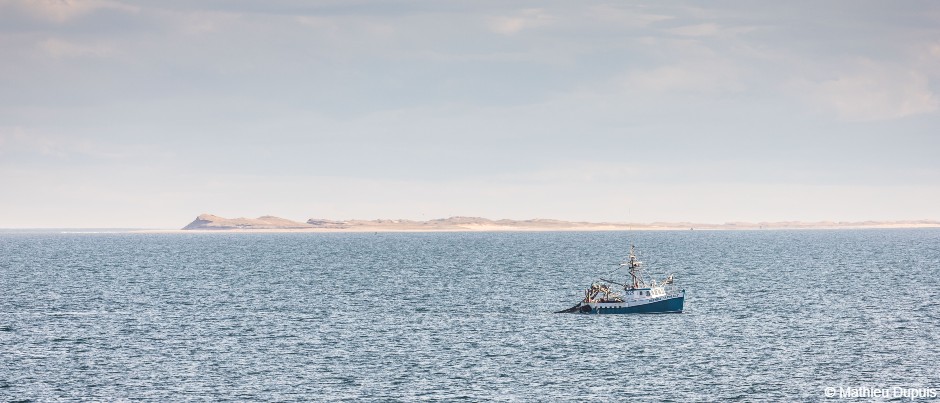
Havre-Saint-Pierre, Côte-Nord
Mathieu Dupuis
5 Surprising Facts about the St. Lawrence
Running across the province of Québec, the St. Lawrence is an integral part of the lives of local residents. In addition, this waterway was the main route for European navigators to explore this vast territory, but its importance was already recognized long before that by the First Nations communities living along its shores. The St. Lawrence plays a vital role in the Québec economy, provides access to drinking water and is a source of electric power. However, do you know these five unusual facts about this mighty waterway?
Exceptional geography
The St. Lawrence is a giant. Originating in Lake Ontario, it extends for nearly 1800 km (1120 mi.) to the Strait of Belle Isle, which lies between Newfoundland and Labrador. The waterway is divided into distinct sections based on its physical properties: the fluvial (river) section, the fluvial estuary, upper estuary and lower estuary, and finally the gulf. (These last three sections are in the maritime regions of Québec.) Tides are observable all the way to Trois-Rivières, nearly 1400 km (870 mi.) inland; they are gradually extinguished in Lake Saint-Pierre, a natural widening of the St. Lawrence.
Saltwater reaches as far as the northeastern tip of Île d’Orléans, an island near Québec City that’s over 1200 km (745 mi.) from the ocean!
A unique lighthouse
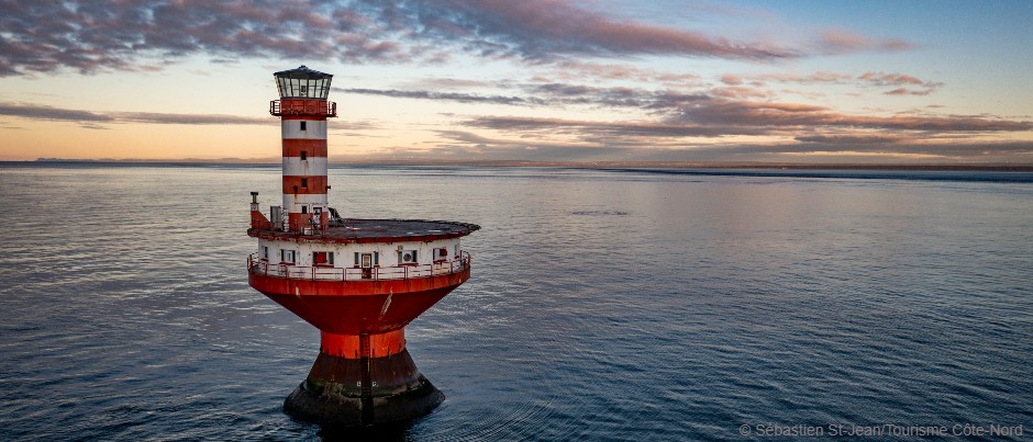
One of the most enigmatic lighthouses on the St. Lawrence stands off Tadoussac, a municipality in Côte-Nord that’s a world-renowned whale-watching destination. This unusual light tower was built right in the middle of the water! Named in honour of the visit of Prince (and future King) Edward VII, the Haut-Fond Prince Lighthouse (also known as the Prince Shoal Lighthouse) marks the boundary between the upper and lower estuary, but more importantly, the presence of a shoal in the Saguenay–St. Lawrence Marine Park, where the depth of the water goes from over 300 metres (985 feet) to less than 50 metres (165 feet).
This sudden change in topography at the mouth of the Saguenay Fjord causes phenomena specific to this area, where different layers of water mix. Much to the delight of curious visitors, this configuration creates a food-rich marine ecosystem that attracts whales!
Canada’s worst maritime disaster
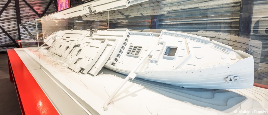
The sinking of the Titanic in 1912 is undoubtedly the most famous shipwreck in the world. But did you know that Canada’s worst maritime disaster happened two years later in the St. Lawrence, off Rimouski? This catastrophic event was overshadowed by the outbreak of the Great War, only a few months later.
Accidentally struck by the Norwegian cargo ship Storstad on a foggy night, the Empress of Ireland sank to the bottom of the St. Lawrence in only 14 minutes. Be sure to stop and visit the Pointe-au-Père Maritime Historic Site to learn more about this tragedy through an exhibition of artefacts recovered from the wreck as well as an immersive multimedia show.
Challenging navigation
The St. Lawrence is one of the world’s major rivers as well as one of the most challenging waterways to navigate. Currents, tides and various reefs, not to mention winter conditions, compel even the most seasoned captains to hand over the helm of their commercial vessels to specialists, the St. Lawrence pilots.
Between Les Escoumins, on the coast of Côte-Nord, and Montréal, three different pilots will take turns at the helm of each vessel. Each one is the guardian of a section of the waterway. Together, they will expertly lead ships to their destination, avoiding all the pitfalls of the St. Lawrence regardless of the season!
Of course, ferry captains make it possible for anyone who decides to cross from one shore to the other to reach their destination safely, whether across a perfectly flat sea on a calm day or through the ice in the winter.
A Second World War battle
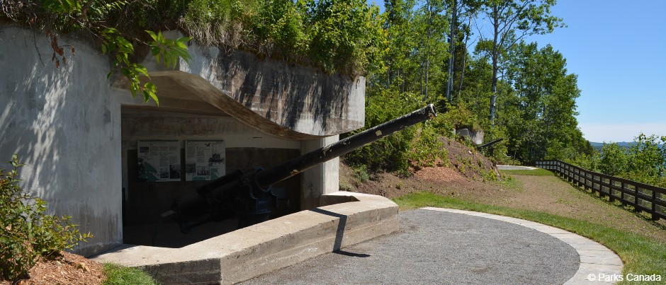
In some of the darkest hours of humanity, as war raged in Europe against the Nazi regime, the conflict spilled over onto the shores of the St. Lawrence during the Battle of the St. Lawrence, an extension of the Battle of the Atlantic.
Between 1942 and 1944, German U-boats (submarines) penetrated the waters of the St. Lawrence in an attempt to disrupt shipping from North America to the other side of the Atlantic. Today, you can still find vestiges of this conflict at the tip of the Gaspé Peninsula in Forillon National Park. Fort Peninsula is the only shore battery from this period that has been completely preserved and is open to the public in Québec.
Were you surprised by any of these five facts? We could also have told you about the rich seabed, which teems with amazing marine life, or mentioned that the St. Lawrence water system is responsible for draining 25% of the world’s freshwater reserves! This watery behemoth definitely has more secrets to share!
In our regions, the St. Lawrence is also:
- 2713 islands and islets
- 13 species of whales (including blue whales, the largest animals on the planet)
- Over 200 species of fresh and saltwater fish
- Over 40 lighthouses
If you liked this article, you might also like...
Author Ulrich Josserand

Originally from the French Alps, Ulrich Josserand is a nature lover and a big fan of outdoor expeditions. Passionate about the great outdoors, he’s proud to have chosen Eastern Québec as his new home. In fact, he’s constantly wowed by the regions of Gaspésie and Bas-Saint-Laurent, where he has lived in recent years. When he’s not seeking adventure in our magnificent mountains and forests or road-tripping along the St. Lawrence, you can find him writing or playing music while dreaming of his next expedition.
(0) comment